Labels
Labels provides the ability to show a text description associated with a map object.
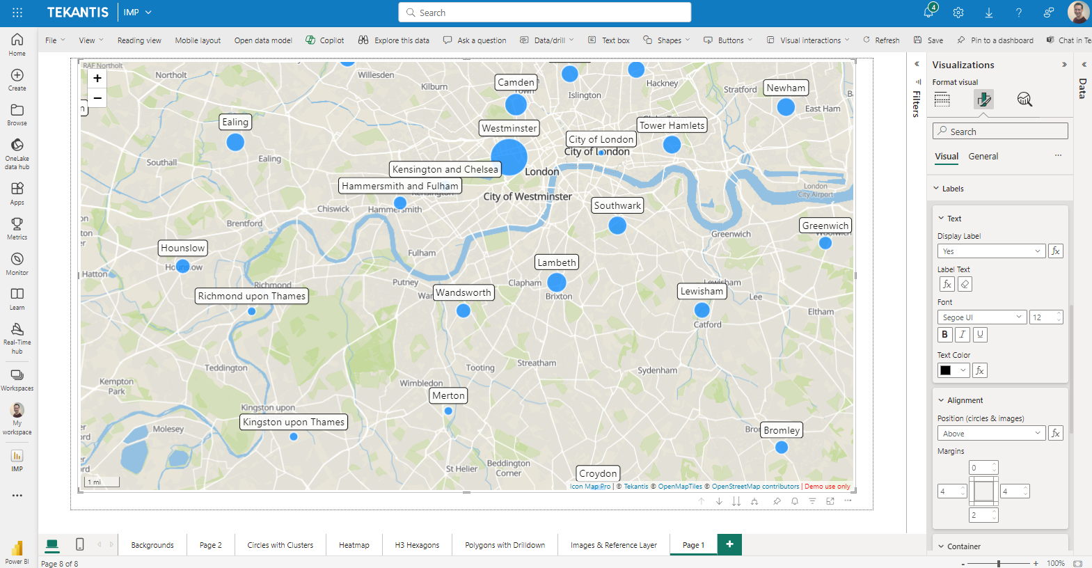
Text
Display Label
To enable data-bound labels, the "Display Label" in the Text section of the Labels configuration area of the formatting options must be set to "Yes".

This can be configured using conditional formatting by selecting a measure or field value that contains the value yes or no. This allows labels to be enabled for specific rows of data.
Label Text
The text to be shown for the label is specified here. Whilst a text value can be hardcoded, it usually makes more sense to select a field value, or a measure containing the text to display.
Font (Font family and decoration are not available for WebGL rendered layers)
Select the font family, size and decoration
Font Color
Specify the font color to display the text in. This can be configured through conditional formatting, with a gradient, rules or a field value containing the color in hex format (#RRGGBB - eg #FF0000 for red).
Alignment
This section allows you to position the label, and configure the margins.

Position
For point data such as circles and images, labels can be positioned:
- Above (above)
- Below (below)
- To the right of (right)
- To the left of (left)
- Centered on (center)
the related map object. The position can be specified with conditional formatting using the a field value or measure containing the text shown in brackets.
Margin
The margin allows you to adjust the white space around the text, between that and the label border.
Container
The container behind the text can be configured as follows:
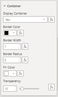
Display Container
Whether to show a box behind the text or not.
Border Color
The color of the box border.
Border Width
Width of the border.
Border Radius
The amount of curve at the corners.
Fill Color
The fill color of the box.
Transparency
How transparent the whole label is.